Ha Giang Loop Map: Routes, Stops & What to Expect
Understanding the Ha Giang Loop Map
When travelers search for a Ha Giang Loop map, they often expect to find one official circular road. In reality, the Loop is better understood as a network of mountain routes connecting towns, passes, villages and landscapes across Ha Giang.
The core route is generally built around Ha Giang City, Quan Ba, Yen Minh, Dong Van, Ma Pi Leng and Meo Vac, with longer journeys extending through Du Gia or beyond Ha Giang toward Cao Bang and Ba Be. Wings' own destination materials describe the core Loop through Ha Giang, Quan Ba, Yen Minh, Dong Van, Ma Pi Leng, Meo Vac and Du Gia.
The route you actually travel therefore depends on how many days you choose.
Wings 2D1N: The Classic Short Loop
The 2D1N itinerary is designed for travelers with limited time.
The route travels from Ha Giang through Quan Ba and Yen Minh toward Dong Van, before crossing the Ma Pi Leng area and returning toward Ha Giang via Meo Vac, Yen Minh and Lung Tam.
Highlights include Bac Sum Pass, Quan Ba Heaven Gate, Twin Mountains, Hmong King's Palace and Dong Van on the first day, followed by Ma Pi Leng, Tu San Canyon and Meo Vac on the second.
Because the journey must fit into two days, the pace is naturally faster than the longer routes.
Wings 3D2N: Classic Loop Plus Du Gia
Adding a third day changes the geography of the journey.
The Wings 3D2N route follows Ha Giang → Quan Ba → Yen Minh → Dong Van → Ma Pi Leng → Meo Vac → Du Gia → Duong Thuong → Thai An → Thuan Hoa → Ha Giang.
Instead of returning quickly after Meo Vac, travelers continue toward Du Gia and then take a greener route back toward Ha Giang.
This creates one of the most important contrasts of the Loop: the rocky northern plateau around Dong Van and Meo Vac versus the valleys and rural landscapes further south.
Wings 4D3N: Lung Khuy, Lung Cu and Du Gia
The 4D3N itinerary expands the Loop further.
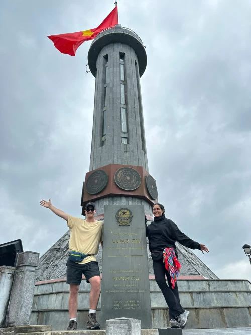
The first day includes Quan Ba, Lung Khuy Cave and Nam Dam Cultural Village. Day two continues through Tham Ma Pass, Hmong King's Palace, Lung Cu Flag Tower and Lo Lo Chai before reaching Dong Van.
From there, the route crosses Ma Pi Leng, reaches the Nho Que River and continues through Meo Vac toward Du Gia before returning via Duong Thuong, Thai An and Thuan Hoa.
On a map, the difference between 3D2N and 4D3N may not initially look enormous. In practice, the additional northern stops significantly change the experience.
Going Beyond Ha Giang: The Wings Big Loop
For travelers with more time, the road does not have to end when the classic Ha Giang Loop finishes.
Wings also offers Big Loop journeys connecting Ha Giang with Cao Bang and Ba Be. The tour collection includes a 4D3N Ha Giang–Ba Be route, 5D4N Ha Giang–Cao Bang route and 6D5N Ha Giang–Cao Bang–Ba Be route.
These journeys turn the Loop into a wider exploration of northern Vietnam.
Ha Giang to Cao Bang
The 5D4N route continues beyond the classic Ha Giang region toward Cao Bang.
After experiencing Ha Giang's northern mountains, the journey passes toward Bao Lac and Pac Bo, then continues to Ban Gioc Waterfall and Nguom Ngao Cave. The final stages include locations such as Phuc Sen, Angel Eye Mountain and Ma Phuc Pass before reaching Cao Bang City.
This route is suitable for travelers who want to combine Ha Giang's mountain passes with some of Cao Bang's most recognizable natural and historical landscapes.
Ha Giang – Cao Bang – Ba Be
The 6D5N journey extends even further.
After Ha Giang and Cao Bang, the route continues toward Ba Be Lake, creating a journey across three major northern destinations.
This is very different from trying to “complete” Ha Giang as quickly as possible. The Big Loop is designed for travelers who want the road trip itself to become a major part of their northern Vietnam experience.
Why Kilometers Can Be Misleading in Ha Giang
Looking at a map can make distances appear surprisingly short. Mountain travel tells a different story.
Roads curve continuously through valleys and passes. Villages, construction, weather and changing surfaces all affect speed. Then there are the stops — viewpoints, meals, photographs and moments when the landscape simply deserves more time.
This means a route with fewer kilometers can sometimes take longer than expected.
When planning Ha Giang, daily pace matters more than total distance.
What Are the Roads Like?
Road conditions vary throughout the region.
Some sections are paved and relatively comfortable, while others may be narrower, uneven or affected by weather and construction. Conditions can also change from season to season.
This is particularly important for travelers considering self-driving. Riding experience should be evaluated realistically rather than assuming that a scooter ride in Hanoi or on an island is equivalent to navigating mountain passes.
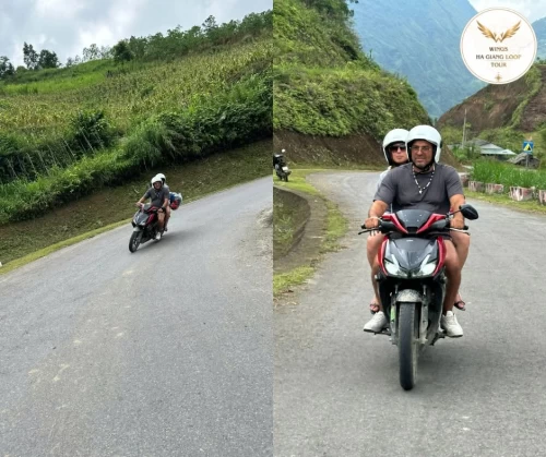
Wings offers Easy Rider as well as self-driving motorbike options, while Jeep and private car tours provide alternatives for travelers who prefer four wheels.
Which Route Should You Choose?
Choose 2D1N when time is extremely limited.
Choose 3D2N for the classic northern journey plus Du Gia.
Choose 4D3N when you want a broader Ha Giang experience including Lung Khuy, Nam Dam, Lung Cu and Lo Lo Chai.
Choose a Big Loop if you have enough time and want to continue beyond Ha Giang into Cao Bang, Ba Be or both.
A Ha Giang Loop map is useful because it helps you understand where you are going. But the real journey begins when those lines on the map become mountain roads in front of you.
Ride Beyond. Discover Ha Giang.